An innovative smartphone app that automatically reports potholes when a motorist feels a bump is set to be trialled in Bristol.
“Street Bump” combines a smartphone’s motion sensors with GPS tracking to pinpoint the jolt of a pothole at a specific location. The location is then automatically sent to an interactive map at council HQ. From there the council can set about targeting the most problematic roads.
“Street Bump” combines a smartphone’s motion sensors with GPS tracking to pinpoint the jolt of a pothole at a specific location. The location is then automatically sent to an interactive map at council HQ. From there the council can set about targeting the most problematic roads.
Currently the app is available for free on Android, but is only operational in Boston, US, where an ongoing trial is set to go fully live this summer.
It was a chance visit to the UK from Boston Mayor Thomas Menino that brought “Street Bump” across the Atlantic.
“He [Mayor Menino] suggested that a council in the UK should give it a go and the cabinet office contacted us to see if we were interested,” Bristol City Council spokeswoman Kate Hartas told Yahoo! News. “We said we’d love to.
“It is an ideal way to ensure potholes in the city are highlighted. Most cities have a traditional problem with back streets that don’t get regularly inspected and we rely on a reporting system for those corridors. We have a very good record with potholes so it would be a manageable trial”.
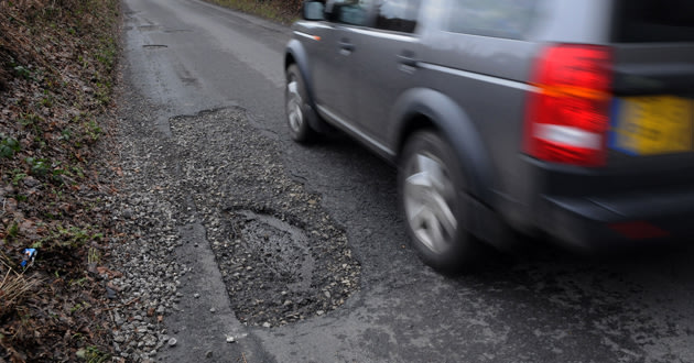
 The app tracks jumps from potholes and reports them to the council.
Bristol residents will be able to sign up for the trial within the next month when the council has the necessary mapping software.
“As far as Bristol goes the condition of our roads are a very important part of our reputation so we take filling them in very seriously,” said Ms Hartas. “It is not something we will force on people, it is for people who are interested in it that will help inform us where potholes are.”
No comments:
Post a Comment